As climate experts had already predicted, the National Oceanic and Atmospheric Administration has announced that La Niña – which was the cause behind so much of the extreme weather towards the end of 2010 and into 2011 – has re-emerged in the Pacific Ocean and is expected to gradually strengthen and continue into the Northern Hemisphere’s winter.

The NOAA will release its annual official winter outlook in mid-October, but with La Niña back, the winter is likely to be drier than normal conditions across the southern tier of the US and wetter than normal conditions in the Pacific Northwest and Ohio Valley.
“This means drought is likely to continue in the drought-stricken states of Texas, Oklahoma and New Mexico,” said Mike Halpert, deputy director of the Climate Prediction Center. “La Niña also often brings colder winters to the Pacific Northwest and the northern Plains, and warmer temperatures to the southern states.”
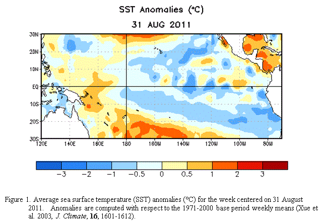
The impressively strong La Niña in 2010-11 was partly responsible for the record US winter snowfall which in turn led to spring flooding, the extreme drought conditions across the United States, as well as extreme weather events around the world, such as heavy rains and monsoons in Asia, the devastating and fatal cyclones in the north east of Australia, and extremely dry period in equatorial eastern Africa.
According to NOAA:
“La Niña is a naturally occurring climate phenomenon located over the tropical Pacific Ocean and results from interactions between the ocean surface and the atmosphere. During La Niña, cooler-than-average Pacific Ocean temperatures influence global weather patterns. La Niña typically occurs every three-to-five years, and back-to-back episodes occur about 50 percent of the time.”
Source: NOAA
